By integrating commercial radar directly into the National Weather Service’s core software, a long-standing gap in U.S. weather coverage begins to narrow, offering forecasters clearer views where storms often form.
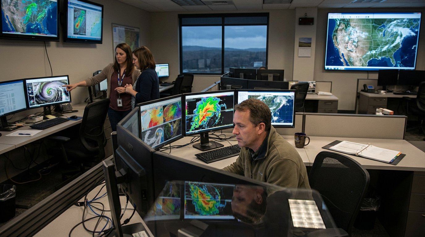
When Climavision data became visible inside the National Weather Service’s operational software, it marked a quiet but consequential shift in how weather warnings may be issued. The update allows NWS forecasters to see commercial radar returns alongside federal NEXRAD data within their primary decision-making system, rather than through separate tools. For a public agency tasked with issuing life-saving warnings under intense time pressure, that integration matters more than any individual sensor.
The challenge the integration addresses is structural, not technical. Nearly 130 million people live in “radar gaps,” areas too distant from government radars to reliably detect dangerous weather close to the ground. These blind spots exist because of terrain, Earth’s curvature, and the spacing of federal infrastructure, and they are precisely where tornadoes, downbursts, and flash-flood-producing storms can develop undetected.
Climavision’s privately built radar network was designed specifically to fill those lower-atmosphere gaps. Since 2021, the company has deployed 29 high-resolution radars, positioned to complement—not replace—the federal network. What changes with the new integration is usability: forecasters can now assess this supplemental data within the same Advanced Weather Interactive Processing System they already use to issue watches and warnings.
This matters because forecasting accuracy is often less about better models than about better situational awareness. When meteorologists must mentally stitch together data from multiple platforms, valuable seconds are lost and confidence can suffer. Bringing commercial radar into the same operational view as government systems lowers that cognitive barrier at moments when clarity is critical.
The effort also reflects a broader shift in how public agencies work with private technology. Through NOAA’s National Mesonet Program, contractors such as KBR and Synoptic Data have helped translate non-federal observations into formats usable by the NWS. The result is a hybrid data environment that leverages commercial agility while keeping federal forecasters in control of warning decisions.
The current rollout is modest—a pilot across selected forecast offices—but its implications are national. If expanded, the integration could change how underserved regions experience severe weather alerts, especially in rural or complex terrain areas. In an era of intensifying storms, seeing into the radar gaps may prove as important as predicting what comes next.